Description
The commune of Sainte-Anastasie-sur-Issole has preserved traces of ancient agropastoral and forestry practices through different structures using local materials and particular construction techniques such as dry stone.
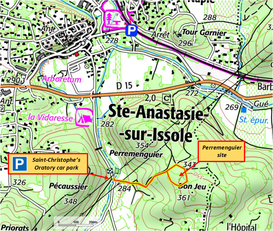
In order to expand the cultivable areas, residents had to develop sloping limestone land. The Perremenguier plot occupies one of these areas formerly conquered from the forest and constitutes a good example of the development of the "saltus", that is to say of the periodically uncultivated part of the municipal territory. We could imagine the cultivation of legumes, chickpeas or small white beans called “coco”, of which Sainte-Anastasie once made a specialty.
Different types of structures have been recorded, mainly retaining walls, huts, scree slopes and niches. The creation of paths allowed convenient access to the site and the passage of carts to transport water, crops and all kinds of materials.
Dry stone structures involve complex know-how. They constitute a material heritage carrying numerous human, social and economic values.
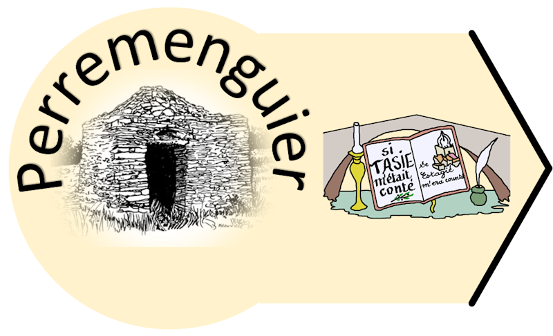
Several members of “Si Tasie m'tait conté” (www.sitasiemetaitconte.fr), an association oriented for many years on the preservation and enhancement of municipal heritage, began in 2021 a long work to rehabilitate the site of Perremenguier : cleaning, clearing, and restoration of walls and huts with the help of a dry stone expert, trainer from the Garde-Freinet Heritage Conservatory thanks to the support of the municipality.
Their objective is twofold : to prevent this site from further damage by restoring it as faithfully as possible and always using the same dry stone technique, and to allow its access to as many visitors as possible in order to inform the public about the lifestyles of the past.
The inventory, carried out in 2008 by the ASER (Association for Safeguarding, Study and Research for Natural and Cultural Heritage) of Centre-Var, made it possible to list 3 cabins, 12 scree slopes, as well as numerous stone walls. separation or support for cultivation on terraces (restanques).
The Napoleonic land register informs us about the division of the current plot into three plots at the beginning of the 1830s. The area then supported agricultural activity essentially concentrated on the highest and least steep plot, but taking into account the small exploitable areas (the most of the terraces are narrow and often cluttered with scree), the crops could only be subsistence, only supplementary.
The dry stone construction technique
It has been used for a very long time, indifferently, by farmers, shepherds and foresters. No need to be a mason or have specific tools, but dry stone works still involve complex know-how and a lot of energy because each stone is manipulated several times before taking its final position in the construction. You therefore had to be in good physical condition to build them.
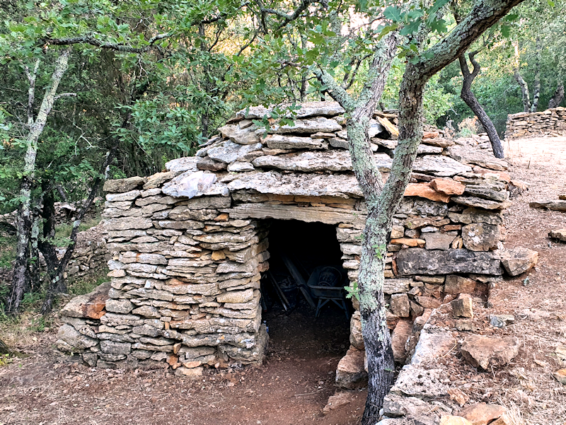 The construction technique of these cabins is that of corbelling which allows a stone space to be vaulted without making formwork, unlike a vault in a church or cellar. This involves raising vertical walls up to approximately 1.50 m then starting the cantilevering at that level. To do this, you must place the following stones, leaving a setback of a few centimeters with each new layer so as to direct them more and more inwards, forming a dome. On the top, a large slab completes the roofing to ensure waterproofing.
Although commonly used in the Var, as in many other geographical areas, this technique is particularly present on the Perremenguier site.
The role of the hut is to serve as shelter for shepherds or farmers but also as a place to store the tools needed to cultivate this poor land. Crops had to be limited to legumes such as lentils or chickpeas mainly, as well as perhaps fruit trees or even a few vine stocks, and a few olive trees whose stumps can still be seen on certain terraces.
There are two types of terraces on the site: those at the top with more or less rounded shapes, which must have served as a parking enclosure for the sheep (brought from the village for the day only because there is no sheepfold here) and those at the bottom, more rectangular, probably dedicated to dry crops.
The commune of Sainte-Anastasie-sur-Issole has preserved traces of ancient agropastoral and forestry practices through different structures using local materials and particular construction techniques such as dry stone.
In order to expand the cultivable areas, residents had to develop sloping limestone land. The Perremenguier plot occupies one of these areas formerly conquered from the forest and constitutes a good example of the development of the "saltus", that is to say of the periodically uncultivated part of the municipal territory. We could imagine the cultivation of legumes, chickpeas or small white beans called “coco”, of which Sainte-Anastasie once made a specialty.
Different types of structures have been recorded, mainly retaining walls, huts, scree slopes and niches. The creation of paths allowed convenient access to the site and the passage of carts to transport water, crops and all kinds of materials.
Dry stone structures involve complex know-how. They constitute a material heritage carrying numerous human, social and economic values.
Several members of “Si Tasie m'tait conté” (www.sitasiemetaitconte.fr), an association oriented for many years on the preservation and enhancement of municipal heritage, began in 2021 a long work to rehabilitate the site of Perremenguier : cleaning, clearing, and restoration of walls and huts with the help of a dry stone expert, trainer from the Garde-Freinet Heritage Conservatory thanks to the support of the municipality.
Their objective is twofold : to prevent this site from further damage by restoring it as faithfully as possible and always using the same dry stone technique, and to allow its access to as many visitors as possible in order to inform the public about the lifestyles of the past.
The inventory, carried out in 2008 by the ASER (Association for Safeguarding, Study and Research for Natural and Cultural Heritage) of Centre-Var, made it possible to list 3 cabins, 12 scree slopes, as well as numerous stone walls. separation or support for cultivation on terraces (restanques).
The Napoleonic land register informs us about the division of the current plot into three plots at the beginning of the 1830s. The area then supported agricultural activity essentially concentrated on the highest and least steep plot, but taking into account the small exploitable areas (the most of the terraces are narrow and often cluttered with scree), the crops could only be subsistence, only supplementary.
The dry stone construction technique
It has been used for a very long time, indifferently, by farmers, shepherds and foresters. No need to be a mason or have specific tools, but dry stone works still involve complex know-how and a lot of energy because each stone is manipulated several times before taking its final position in the construction. You therefore had to be in good physical condition to build them.
The construction technique of these cabins is that of corbelling which allows a stone space to be vaulted without making formwork, unlike a vault in a church or cellar. This involves raising vertical walls up to approximately 1.50 m then starting the cantilevering at that level. To do this, you must place the following stones, leaving a setback of a few centimeters with each new layer so as to direct them more and more inwards, forming a dome. On the top, a large slab completes the roofing to ensure waterproofing.Although commonly used in the Var, as in many other geographical areas, this technique is particularly present on the Perremenguier site.
The role of the hut is to serve as shelter for shepherds or farmers but also as a place to store the tools needed to cultivate this poor land. Crops had to be limited to legumes such as lentils or chickpeas mainly, as well as perhaps fruit trees or even a few vine stocks, and a few olive trees whose stumps can still be seen on certain terraces.
There are two types of terraces on the site: those at the top with more or less rounded shapes, which must have served as a parking enclosure for the sheep (brought from the village for the day only because there is no sheepfold here) and those at the bottom, more rectangular, probably dedicated to dry crops.
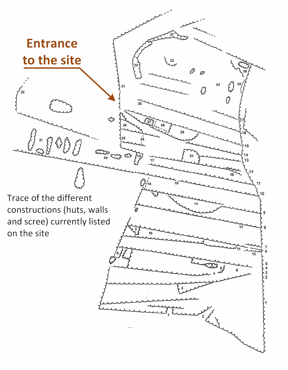
List of structures
1 - Shed in a stone reserve
2 - Entrance to the agricultural area
3 - Stone reserve
4 - Entrance to an agricultural area
5 - Stone reserve
6 - Wall
7 - Stone reserve
8 - Cultivation areas
9 - Cultivation area
10 - Stone reserve
11 - Wall
12 - Floor layout (passage)
13 - Retaining wall
14 - Stone reserve
15 - Passage between two terraces
16 - Field-laid slabs
17 - Cultivation area
18 - Retaining structures
19 - Stone reserve with "garenne"
20 - Stone reserve
21 - Stone reserve
22 - Municipal road
23 - Stone reserve
24a - Wall showing a “sabre cut”
24b - Wall showing a “sabre cut”
25 - Small niche (for hive)
26 - Cultivation area
27 - Shed
28 - Cultivation area
29 - Stone reserve
30 - Retaining wall presenting a particular appearance
31 - Parcel boundary wall
32 - Shed
33 - Stone reserve
34 - Several heap of stones
35 - Rock block (natural curiosity)
36 - Cultivation area
37 - Stone reserve

Contact
Association Si Tasie m'était conté :
- Mail : sitasiemetaitconte@gmail.com
- Website : http://sitasiemetaitconte.fr/
Visitor/hiker friends, please send us your comments/suggestions by email in order to help us improve this historic site. We will do our best to take this into account.